Local start-up Arlula looks to make better use of satellite imaging equipment by expanding access to include small businesses and organisations – even individuals.
While earth satellite data and imagery are not new innovations, for a long time their usage has been in the main confined to government use, with the technology not readily accessible to smaller businesses who could benefit from the rich information they offer. Australian start-up Arlula aims to change that by providing Earth Observation (EO) data and imagery for small and large businesses, as well as individuals, so that they may be able to gain important insights and make intelligent and data-driven decisions.
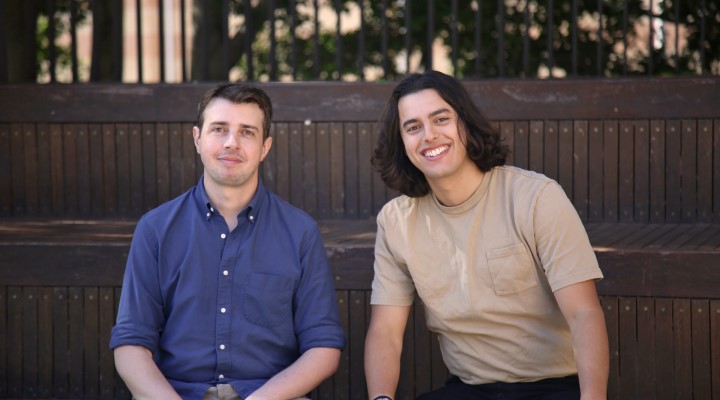
Karl Aguilar, ISB journalist, spoke with Sebastian Chaoui – an engineer who led Australia’s first-ever mission to the International Space Station – who co-founded Arlula with Arran Salerno.
ISB: How did the idea for Arlula first come about?
SC: Having worked in the space industry for over a decade, I realised it is one of the most wasteful industries. More so, space assets – including satellite imagery – were not being used to their full potential. Despite thousands of satellites monitoring the Earth’s surface, their operators were hyper-focused on selling this data only to governments, with a particular focus on the United States.
Arlula aims to address this problem by creating an open-access platform that gives users from anywhere in the world, regardless of size, access to satellite imagery at a very low cost to enable decision-making that is both informed and data-driven.
ISB: Can you explain a bit more about what EO is and what makes it different from other satellite imagery services?
SC: Satellite imagery is a subset of EO data, which more broadly refers to any data from satellites or other airborne platforms that provides insights into Earth’s physical, chemical and biological systems. Satellite imagery enables us to monitor the changes happening on the planet’s surface at scale. For instance, you could have a satellite orbit over one farm in Australia and another one over Brazil and within 90 minutes, you would be able to collect information about both areas. This makes it an essential tool for understanding and managing phenomena such as environmental degradation, wildlife movement, natural disasters, urbanisation and much more, on a global scale. We are trying to make this type of technology accessible and useful to small businesses.
ISB: How does Arlula use EO data in a way that makes it stand out from your competitors?
SC: Arlula provides unprecedented access to EO data to organisations of all sizes, from as little as US$10 ($15) per kilometre of imagery. We have partnered with commercial and government satellite operators, and global data suppliers, to aggregate satellite imagery archives and make them accessible via cloud-based infrastructure. This is the first platform of its kind and it will open up new opportunities for businesses to make use of satellite imagery to make data-driven decisions.
ISB: Please tell us a bit more about Geostack Terra and how it will further improve the EO data you’re providing.
SC: Geostack Terra is the platform on which businesses are able to efficiently and autonomously gain access to EO data from satellite operators around the globe. Through the use of this cloud-based platform, businesses will be able to manage, buy and visualise data within the platform, without having to install any additional software or needing to have advanced computing expertise to run it. Making sure anyone within an organisation can access and manage the EO data that is being purchased is a huge challenge for current consumers of satellite data, and something that Arlula strives to address.
ISB: In what way has your experience in the space industry made you become better informed in piloting this venture?
SC: Throughout the last decade, my co-founder, Arran, and I have witnessed significant changes in this industry. From the hardware being launched to the data products being generated, the pace of change has evolved immensely. The next great challenge for the space industry will be to make this type of technology useful to everyone on the planet, to ensure people benefit from this new frontier.
“It’s not that small businesses do not want to use this technology [satellite imagery}, they just did not have access to it.”
It has made me become more keenly aware of the opportunities available and the challenges at hand that have guided us in our journey with this venture. To provide an example, a lot of the technology and hardware is destroyed following each mission, even though smaller players could greatly benefit from using it. From a commercial perspective, we think that this was not a smart use of assets, which is what we’re trying to [address] at Arlula.
ISB: How were you able to achieve success in commercialising this service despite it being traditionally government-facing?
SC: While governments have long been the only institutions that were able to access this breadth of EO data, we felt it was a no-brainer that small businesses and other industry players would greatly benefit from it as well. It’s not that small businesses do not want to use this technology, they just did not have access to it and were, therefore, unaware that such wealth of information exists. One of the biggest challenges we’ve had was convincing commercial satellite operators to understand the value in providing their data and imagery to smaller players who don’t have the same budgets that governments do. With Arran’s commercial and legal background, we’ve been able to build infrastructure that connects both sides of the market with a commercially accessible business model.
ISB: What contributions has CSIRO made in supporting the venture?
SC: Our $2.2 million seed funding round was led by Main Sequence, Australia’s deep tech investment fund founded by CSIRO. Outside of that, we also have an independent partnership with CSIRO where we have been working with them to integrate our technology into the Easi hub Earth observation platform. With this integration, it will be easier for scientists to access commercial EO data for new projects.
ISB: How do you envision Arlula developing in the next couple of years?
SC: First and foremost, we want to expand our business and grow the team to at least 15 people by the end of the year. We’re looking to create a diverse team from different walks of life and hire more talent in engineering, sales and customer service. From there, we’d love to scale Geostack Terra into new international markets to help businesses and governments make meaningful impact using the data collected from space.
PQ: “It will open up new opportunities for businesses to make use of satellite imagery.”
This story first appeared in issue 41 of the Inside Small Business quarterly magazine


